First results of multidisciplinary investigations for the hydrogeological conceptual modelling of loess deposits in eastern Croatia
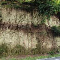
Accepted: 26 March 2020
All claims expressed in this article are solely those of the authors and do not necessarily represent those of their affiliated organizations, or those of the publisher, the editors and the reviewers. Any product that may be evaluated in this article or claim that may be made by its manufacturer is not guaranteed or endorsed by the publisher.
Loess is a widespread continental aeolian sediment. Groundwater generally represents the most important source of potable water in loess areas, where loess is the aquitard overlying the aquifer system. This work investigates loess deposits of eastern Croatia that overlie a sandy aquifer exploited for potable and agricultural purposes. The genesis of the deposit and the depositional and post-depositional processes affecting its structure were reviewed in this work and integrated with the estimated hydrogeological properties of the material to propose a preliminary hydrogeological conceptual model of the loess-sand system. The results of published granulometric analyses were used to calculate the effective porosity and the hydraulic conductivity of the material employing an analytical approach. The eastern Croatian loess is a silty deposit originated during Middle-Upper Pleistocene glacial periods. The sediments produced by glacial grinding were transported and deposited by the Danube fluvial system and subsequently remobilised by wind forming the loess. During the interglacial periods, the pedogenesis of the deposit occurred, with bioturbations and discontinuities by living organisms at the micro- and macro-scale. The deposition of a new loess layer compacted and consolidated the previously deposited loess leading to the development of a sub-vertical pore structure and sub-vertical cracks at the micro- and macro-scale, respectively. The calculations from the grain size distributions point to the low effective porosity (5-12%) and hydraulic conductivity (~10-9 m/s) of both loess and pedocomplexes supporting their aquitard behaviour. The infiltration of surficial waters and their flow toward the underlying sandy aquifer is locally enhanced by the post-depositional discontinuities that constitute preferential flow paths within the loess aquitard. These results highlight the need of detailed hydrogeological investigations in loess deposits to address the impact of post-depositional processes on their hydrogeological behaviour and the upscaling of their hydrogeological properties for proposing specific groundwater protection strategies in loess areas.
PAGEPress has chosen to apply the Creative Commons Attribution NonCommercial 4.0 International License (CC BY-NC 4.0) to all manuscripts to be published.