Parametric and numerical modeling tools to forecast hydrogeological impacts of a tunnel


Published: 31 March 2022
Abstract Views: 762
PDF: 625
Publisher's note
All claims expressed in this article are solely those of the authors and do not necessarily represent those of their affiliated organizations, or those of the publisher, the editors and the reviewers. Any product that may be evaluated in this article or claim that may be made by its manufacturer is not guaranteed or endorsed by the publisher.

Authors

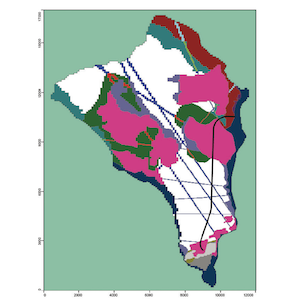
The project of interest involving a hydroelectrical diversion tunnel through a crystalline rock massif in the Alps required a detailed hydrogeological study to forecast the magnitude of water inflows within the tunnel and possible effects on groundwater flow. The tunnel exhibits a length of 9.5 km and is located on the right side of the Toce River in Crevoladossola (Verbania Province, Piedmont region, northern Italy). Under the geological framework of the Alps, the tunnel is located within the Lower Penninic Nappes in the footwall of the Simplon Normal Fault, and the geological succession is mostly represented by Antigorio gneiss (meta-granites) and Baceno metasediments (metacarbonates). Due to the presence of important mineralized springs for commercial mineral water purposes, the abovementioned hydrogeological study focused on both quantity and quality aspects via rainfall data analysis, monitoring of major spring flow rates, monitoring of hydraulic heads and pumping rates of existing wells/boreholes, hydrochemical and isotopic analysis of springs and boreholes and hydraulic tests (Lefranc and Lugeon). The resulting conceptual model indicated dominant low-permeability (aquitard) behavior of the gneissic rock masses, except under conditions of intense fracturing due to tectonization, and aquifer behavior of the metasedimentary rocks, particularly when interested by dissolution. Groundwater flow systems are mainly controlled by gravity. The springs located near the Toce River were characterized by high mineralization and isotopic ratios, indicating long groundwater flow paths. Based on all the data collected and analyzed, two parametric methods were applied: 1) the Dematteis method, slightly adapted to the case study and the available data, which allows assessment of both potential inflows within the tunnel and potential impacts on springs (codified as the drawdown hazard index; DHI); 2) the Cesano method, which only allows assessment of potential inflows within the tunnel, thereby discriminating between major and minor inflows. Contemporarily, a groundwater flow model was implemented with the equivalent porous medium (EPM) approach in MODFLOW-2000. This model was calibrated under steady-state conditions against the available data (groundwater levels inside wells/piezometers and elevation and flow rate of springs). The Dematteis method was demonstrated to be more reliable and suitable for the site than was the Cesano method. This method was validated considering a tunnel through gneissic rock masses, and this approach considered intrinsic parameters of rock masses more notably than morphological and geomorphological factors were considered. The Cesano method relatively overestimated tunnel inflows, considering variations in the topography and overburden above the tunnel. Sensitivity analysis revealed a low sensitivity of these parametric methods to parameter values, except for the rock quality designation (RQD) employed to represent the fracturing degree. The numerical model was calibrated under ante-operam conditions, and sensitivity analysis evaluated the influence of uncertainties in the hydraulic conductivity (K) values of the different hydrogeological units. The hydraulic head distribution after tunnel excavation was forecasted considering three scenarios, namely, a draining tunnel, tunnel as a water loss source, and tunnel sealed along its aquifer sectors, considering 3 levels of K reduction. Tunnel impermeabilization was very effective, thus lowering the drainage rate and impact on springs. The model quantitatively defined tunnel inflows and the effects on spring flow at the surface in terms of flow rate decrease. The Dematteis method and numerical model were combined to obtain a final risk of impact on the springs. This study likely overestimated the risk because all the values assigned to the parameters were chosen in a conservative way, and the steady-state numerical simulations were also very conservative (the transient state in this hydrogeological setting supposedly lasts 1–3 years). Monitoring of the tunnel and springs during tunnel boring could facilitate the feedback process.


Aller L, Bennett T, Lehr JH, Petty RJ (1985) DRASTIC - a standardized system for evaluating ground water pollution potential using hydrogeologic settings: U.S. Environmental Protection Agency, Robert S. Kerr Environmental Research Laboratory, Office of Research and Development, EPA/600/2–85/018, 163 pp.

Astolfi G, Sapigni M (1999) Impianto Crevola Toce III - Progetto di Massima - Relazione geologica “Crevola Toce III Plant - Preliminary Design - Geological Report”. Enel Spa, internal report.

Barton CM (1974) Engineering classification of rock masses for the design of tunnel support. Rock Mechanics, 6, 4, pp.189-239. DOI: https://doi.org/10.1007/BF01239496

Bigioggero B, Boriani A, Origoni Giobbi E (1977) Microstructure and mineralogy of an Orthogneiss (Antigorio Gneiss - Lepontine Alps). Rendiconti Società Italiana di Mineralogia e Petrologia, 33, 99-108.

Bistacchi A, Massironi M (2000) Post-nappe brittle tectonics and kinematic evolution of the north-western Alps: an integrated approach. Tectonophysics, 327, 267-292. DOI: https://doi.org/10.1016/S0040-1951(00)00206-7

Bortolami GC, Ricci B, Sella GF, Zuppi GM (1979) Isotope hydrology of the Val Corsaglia, Maritime Alps, Piedmont, Italy, in Isotope Hydrology 1978, Vol.I, IAEA Symposium 228, June 1978, Neuheberg, Germany, pp. 327-350.

Campani M, Mancktelow N, Seward D, Rolland Y, Mu?ller W, And Guerra I (2010) Geochronological evidence for continuous exhumation through the ductile-brittle transition along a crustalscale low-angle normal fault: Simplon Fault Zone, central Alps. Tectonics, 29, TC3002, doi:10.1029/2009TC002582. DOI: https://doi.org/10.1029/2009TC002582

Canuti P, Ermini L, Gargini A, Martelli L, Piccinini L, Vincenzi V (2009) Le gallerie TAV attraverso l’Appennino toscano: impatto idrogeologico ed opere di mitigazione “The High Velocity tunnels trhough the Tusan Apennine: hydrogeological impact and mitigation strategies”. Edifir-Edizioni Firenze, Firenze, pp. 207.

Castiglioni GB (1958) Studio geologico e morfologico del territorio di Baceno e Premia “Geological and morphological study of the Baceno and Premia territory”. Memorie degli Istituti di Geologie e Mineralogie dell’Università di Padova, vol. XX, 2-82.

Cesano D, Olofsson B, Bagtzoglou (2000) Parameters regulating groundwater inflows into hard rock tunnels-a statistical study of the Dolmen tunnel in southern Sweden. Tunneling and underground Space Technology, V. 15/2, p. 153-165 DOI: https://doi.org/10.1016/S0886-7798(00)00043-2

Civita M (1973) Schematizzazione idrogeologica delle sorgenti normali e delle relative opere di captazione “Hydrogeological sketch of normal springs and their capture works”. In Memorie e Note Ist. Geol. Aplplic. Napoli, 12, 1973, pp.1-34.

Civita M, De Maio M (2000) Valutazione e cartografia automatica degli acquiferi all’inquinamento con il sistema parametrico SINTACS R5 “Evaluation and automatic cartography of aquifers vulnerability to pollution with the parametric method SINTACS R5” Pitagora Editore, Bologna, 275pp.

Civita M (2005) - Idrogeologia applicata e ambientale “Applied and environmental hydrogeology”. Casa Editrice Ambrosiana, pp 331-336.

Civita M, Gargini A, Pranzini G (1999) Metodologia di redazione della carta della vulnerabilità intrinseca e del rischio di inquinamento degli acquiferi del Valdarno Medio “Mapping metholodgy of intrinsic vulnerability and pollution risk for the Valdarno Medio aquifers”. Quaderni di Geologia Applicata, 2, Vol.1, Pp. 1.59-1.73.

Clark I, Fritz P (1997) Environmental Isotopes in Hydrogeology, CRC Press LLC.

Craig H (1961) Isotopic variations in meteoric waters. Science, 133, pp. 1702-1703. DOI: https://doi.org/10.1126/science.133.3465.1702

Deere DU, Deere DW (1989) Rock Quality Designation (RQD) After Twenty Years - Technical Report GL-89-1, U.S. Army Engineer Waterways Experiment Station, Vicksburg, MS 39180.

Deere DU, Merritt AH, And Coon RF (1969) “Engineering Classification Of In Situ Rock” - Air Force Systems Command, Kirtland Air Force Base, Report AFWL-64-144.

Dematteis A, Kalamaras G, Eusebio A (2001) “A system approach for evaluating springs drawdown due to tunneling “ - AITES-ITA 2001 World Tunnel Congress: Progress in tunnelling after 2000 – p. 257-264. Milano, 10-13 June 2001

Domenico P, Schwartz F (1998), “Physical and chemical Hydrogeology”, second edition. John Wiley & Sons, Inc., New York, USA

Einstein HH (1988) “Special lecture: landslide risk assessment procedure” - Atti di “V International Symposium on Landslides”, Losanna, 2, pp.1075-1090.

Federici P C, Saccani F, Parietti P 1967 Le acque salutari della Val d’Ossola “The healthy waters of Val d’Ossola”. Collana di monografie dell’ateneo parmense, n. 18.

Federico F (1984) Il processo di drenaggio da una galleria in avanzamento “The drainage process from an advancing tunnel”. Rivista Italiana di Geotecnica, V.4, p. 191-208.

Gargini A, Piccinini L, Martelli L, Rosselli S, Bencini A, Messina A, Canuti P (2006) Idrogeologia delle unità torbiditiche: un modello concettuale derivato dal rilevamento geologico dell’Appennino Tosco-Emiliano e dal monitoraggio ambientale per il tunnel alta velocità ferroviaria Firenze-Bologna “Hydrogeology of turbidite units: a model conceptual derived from the geological survey of the Tosco-Emiliano Apennines and environmental monitoring for the tunnels of Florence-Bologna high speed railway line”. Bollettino Società Geologica Italiana, 125 (2006), 293-327.

Goodman RE, Moye D, Schalkwyk A, Javandel I. (1965) “Groundwater inflows during tunnel driving.”- Geol. Soc. America Publication – Engneering Geology, V. 2, p. 39-56.

Grasemann B, Manktelow N (1993) Two-dimensional thermal modelling of normal faulting: the Simplon Fault Zone, Central Alps, Switzerland. Tectonophysics, 225, 155-165. DOI: https://doi.org/10.1016/0040-1951(93)90277-Q

Grosjean G, Sue C, Burkhard M (2004) Late Neogene extension in the vicinity of the Simplon fault zone (central Alps, Switzerland). Eclogae geol. Helv., 97; 33-46. DOI: https://doi.org/10.1007/s00015-004-1114-9

Harbaugh AW, Banta ER, Hill MC, Mcdonald G (2000) MODFLOW-2000, The U.S. Geological Survey modular groundwater model – User Guide to modularization concepts and the ground-water flow process - U.S. Geological Survey, Open-File Report 00-92 DOI: https://doi.org/10.3133/ofr200092

Kanit T, Forest S, Galliet I, Mounoury V, Jeulin D. (2003) Determination of the size of the representative volume element for random composites: statistical and numerical approach. International Journal of Solids and Structures, 40, 3647–3679. DOI: https://doi.org/10.1016/S0020-7683(03)00143-4

Jiao Y, Hudson JA (1995) “The Fully-Coupled Model for Rock Engineering Systems.” - International Journal of Rock Mechanics and Mining Sciences & Geomechanics Abstracts, 32, (5), 491-512. Oxford, United Kingdom: Elsevier Science) DOI: https://doi.org/10.1016/0148-9062(95)00038-I

Lei S (1999) “An analytical solution for steady state flow into a tunnel.” Ground Water – V. 37/1, p. 23-26. DOI: https://doi.org/10.1111/j.1745-6584.1999.tb00953.x

Lei S (2000) “Steady state flow into a tunnel with constant pressure boundary”. Ground Water V.38/5, p. 643-644. DOI: https://doi.org/10.1111/j.1745-6584.2000.tb02697.x

Leopold LB Et Al (1971) “A procedure for evaluating environmental impact”, U.S. Geological Survey Circular 645, Washington D.C., U.S. Dep. Of the Interior. DOI: https://doi.org/10.3133/cir645

Loew S (2002) In Barla G & Barla M (EDS) Le opere in sotterraneo e il rapporto con l’ambiente “Underground works and their relation with environment” - IX ciclo MIR, Torino 26-27 novembre 2002, Patron Editore, p. 201-217.

Long JCS, Remer JS, Wilson CR, Witherspoon PA (1982) Porous Media Equivalent for Networks of Discontinuous Fractures. Water Resources Research, 18(3), 645-658. DOI: https://doi.org/10.1029/WR018i003p00645

Maillet E (1905) Essais d’hydraulique souterraine et fluviale “Evaluations on underground and river hydraulic”. Librairie Sci. Hermann Paris, 218pp. DOI: https://doi.org/10.2307/198208

Mancktelow N (1985) The Simplon line: a major displacement zone in the western Lepontine Alps. Eclogae geol. Helv. 78, 73-96.

Martinotti G Per Enel Produzione (1993) Impianto di Piedilago – Studio geologico strutturale e idrologico “Piedilago Plant - Geological, structural and hyrologic study”. Rapporto finale del 30 aprile 1993.

Martinotti G, Marini L, Hunziker J C, Perello P, Pastorelli S (1999) Geochemical and geothermal study of springs in the Ossola-Simplon Region, in Eclogae geol. Helv. 92 (1999), pp. 295-305.

Masset O, Loew S (2010) Hydraulic conductivity distribution in crystalline rocks, derived from inflows to tunnels and galleries in the Central Alps, Switzerland. Hydrogeology Journal, 18, pp. 863-891. DOI: https://doi.org/10.1007/s10040-009-0569-1

Maxelon M, Mancktelow N (2005) Three-dimensional geometry and tectonostratigraphy of the Pennine zone, Central Alps; Switzerland and Northern Italy. Earth-Science Reviews, 71, 171-227. DOI: https://doi.org/10.1016/j.earscirev.2005.01.003

Mcdonald MG, Harbaugh AW (1988) A Modular Three-Dimensional Finite-Difference Ground-Water Flow Model - U.S. Geological Survey, Techniques of Water-Resources Investigations, Book 6, Chapter A1

Mehl SW, Hill MC ( 2001) MODFLOW-2000, The U.S. Geological Survey Modular Ground-Water Model - User Guide to the Link-Amg (LMG) Package for Solving Matrix Equations Using an Algebraic Multigrid Solver: U.S. Geological Survey Open-File Report 01-177, 33 p. DOI: https://doi.org/10.3133/ofr01177

Milnes AG, Greller M, Mu?ller R (1981) Sequence and style of major post-nappe structures, Simplon-Pennine Alps. Journal of Sructural Geology, 3, 411-420. DOI: https://doi.org/10.1016/0191-8141(81)90041-9

Mun Y, Uchrin CG (2004) Development and Application of a MODFLOW Preprocessor Using Percolation Theory for Fractured Media. Journal of the American Water Resources Association, 40(1), 229-239. DOI: https://doi.org/10.1111/j.1752-1688.2004.tb01021.x

Pastorelli S, Marini L, Hunziker J (2001) Chemistry, isotop values (?D, ?18O, ?34SSO4) and temperatures of the water inflows in two Gotthard tunnels, Swiss Alps, in Applied Geochemistry 16 (2001), pp. 633-649. DOI: https://doi.org/10.1016/S0883-2927(00)00056-1

Prudic DE (1989) Documentation of a computer program to simulate stream-aquifer relations using a modular, finite-difference, groundwater flow model. U.S. Geological Survey, Open-File Report 88-729. DOI: https://doi.org/10.3133/ofr88729

Schmidt C, Preiswerk H (1905) Geologische Karte der Simplongruppe. Beiträge zur Geologischen Karte der Schweiz, [N.F.] 26, Spezialkarte No. 48.

Steck A (2008) Tectonics of the Simplon massif and Lepontine gneiss dome: deformation structures due to collision between the underthrusting European plate and the Adriatic indenter. Swiss Journal of Geoscience, 101, 515–546. DOI: https://doi.org/10.1007/s00015-008-1283-z

Thapa BB, Nolting RM, Teske MJ, Mcrae MT (2005) “Predicted and observed groundwater inflows into two rock tunnels” - RECT Proceedings, Chapter 50, p. 556-567.

Thornthwaite CW, Mather JR (1957) Instructions and tables for computing potential evapotranspiration and the water balance. Drexel Institute of Technology, Publications in Climatology, Vol. X, 3, 185-311 p, Centerton, New Jersey (USA).

Urey HC, Lowenstam HA, Epstein S, Mckinney CR (1951) Measurement of paleotemperatures and temperatures of the Upper Cretaceous of England, Denmark and the Southern United States. Geological Society of America Bullettin, 62, pp. 399-416. DOI: https://doi.org/10.1130/0016-7606(1951)62[399:MOPATO]2.0.CO;2

Zaadnoordijk WJ (2009) Simulating Piecewise-Linear Surface Water and Ground Water Interactions with MODFLOW. Ground Water, 47(5), 723–726 DOI: https://doi.org/10.1111/j.1745-6584.2009.00582.x

Zheng C & Bennevy GD (1995) Applied contaminant transport modelling – Van Nostrand Reinhold ITP

Zwingmann H, Mancktelow N (2004) Timing of Alpine fault gauges. Earth and Planetary Science Letters, 223, 415-425. DOI: https://doi.org/10.1016/j.epsl.2004.04.041

Vincenzi, V., Piccinini, L. ., Gargini, A. ., & Sapigni, M. . (2022). Parametric and numerical modeling tools to forecast hydrogeological impacts of a tunnel. Acque Sotterranee - Italian Journal of Groundwater, 11(1), 51–69. https://doi.org/10.7343/as-2022-558

Downloads

Download data is not yet available.

Citations