FOR AUTHORS
Search
Search Results
Found 25 items.
-
Tight-coupling of groundwater flow and transport modelling engines with spatial databases and GIS technology: a new approach integrating Feflow and ArcGIS
Published: 30 September 20121451PDF: 1901 -
The synthesis of decades of groundwater knowledge: the new Hydrogeological Map of Rome
Published: 31 December 20151618PDF: 618 -
Groundwater Flow and Transport Model in Cecina Plain (Tuscany, Italy) using GIS processing
Published: 30 March 20151002PDF: 709 -
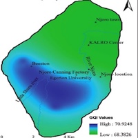
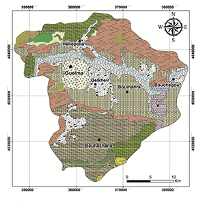
Assessing the Impact of land-use types on the groundwater quality: a case study of Mid River Njoro Catchment, Kenya
Published: 22 December 2020850PDF: 486 -

Geospatial delineation and mapping of groundwater potential in Embu County, Kenya
Published: 15 May 20191927PDF: 865 -

The use of geographic information systems and remote sensing to evaluate climate change effect on groundwater: application to Mostaganem Plateau, Northwest Algeria
Published: 30 December 2024330PDF: 125 -
MAR site suitability mapping for arid–semiarid regions by remote data and combined approach: A case study from Balochistan, Pakistan
Published: 29 September 20211885PDF: 849 -

The FREEWAT platform for the assessment of water availability and quality
Published: 29 September 20171021PDF: 494 -
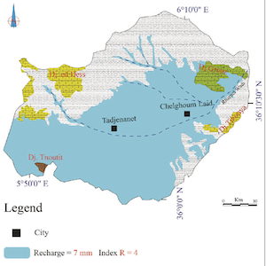
Mapping natural groundwater potential recharge zones using GIS-AHP in the Upper Cheliff alluvial aquifer, Algeria
Published: 28 March 2024692PDF: 384 -

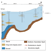
A methodology for the preliminary characterisation of the river boundary condition in finite difference groundwater flow numerical models
Published: 30 September 20191088PDF: 511 -
The riverbank filtration plant in S. Alessio (Lucca): monitoring and modeling activity within EU the FP7 MARSOL project
Published: 30 September 2014813PDF: 396 -

Spatial analysis and simulation tools for groundwater management: the FREEWAT platform
Published: 29 September 20171746PDF: 571 -

Slovenian test case Vrbanski Plato aquifer in the EU HORIZON 2020 FREEWAT project
Published: 29 September 20172892PDF: 410 -

Hydrogeological map of Italy: the preliminary Sheet N. 348 Antrodoco (Central Italy)
Published: 28 July 20161140PDF: 714 -

Modelling the impact of rural land use scenarios on water management: a FREEWAT approach to the Bakumivka catchment case study, Ukraine
Published: 29 September 20171127PDF: 602 -
Mapping the intrinsic potential of water infiltration in urban subsurface: feedback from France
Published: 30 September 2024268PDF: 172 -

The H2O20 FREEWAT participated approach for the Follonica-Scarlino aquifer case study. A common space to generate shared knowledge on the value of water
Published: 29 September 20171049PDF: 418 -

Map of the vulnerabiliy to pollution of the Apuo-Versilia aquifer (Tuscany - Italy)
Published: 26 June 20191085PDF: 220 -

FREEWAT: a free and open source modelling platform for water resource management
Published: 29 September 2017920PDF: 547 -
Preliminary identification of areas suitable for Sustainable Drainage Systems and Managed Aquifer Recharge to mitigate stormwater flooding phenomena in Rome (Italy)
Published: 20 December 20221036PDF: 830
1 - 25 of 25 items