FOR AUTHORS
Search
Search Results
Found 17 items.
-
Hydrogeological map of Italy: the preliminary Sheet N. 348 Antrodoco (Central Italy)
Published: 28 July 20161140PDF: 714 -
Mapping the intrinsic potential of water infiltration in urban subsurface: feedback from France
Published: 30 September 2024274PDF: 174 -
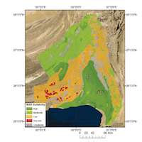
MAR site suitability mapping for arid–semiarid regions by remote data and combined approach: A case study from Balochistan, Pakistan
Published: 29 September 20211886PDF: 851 -
Preliminary groundwater modelling by considering the interaction with superficial water: Aosta plain case (northern Italy)
Published: 30 March 2013939PDF: 612 -
[The scientific collaboration on a hydrogeological mapping project between the Geological Survey of Italy (ISPRA) and the China Geological Survey]
Published: 24 June 2021447PDF: 256 -
Methodological approach for evaluating the geo-exchange potential: VIGOR Project
Published: 30 December 20121247PDF: 1013 -
Mapping natural groundwater potential recharge zones using GIS-AHP in the Upper Cheliff alluvial aquifer, Algeria
Published: 28 March 2024697PDF: 386 -
Geospatial delineation and mapping of groundwater potential in Embu County, Kenya
Published: 15 May 20191930PDF: 865 -
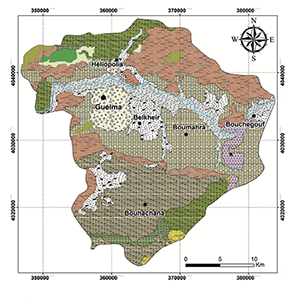
Water quality caracterization of Drean-Annaba aquifer (NE Algeria): using hydrochemical and isotopic tools
Published: 30 December 2024479PDF: 160 -
A new tool available for hydrogeologists: the Airborne EM method
Published: 30 December 20141049PDF: 2512 -
[The activity plan for the realization of the Hydrogeological Map of Italy at 1:500,000 scale]
Published: 28 March 2024333PDF: 239 -
Mapping saltwater intrusion via Electromagnetic Induction for planning a Managed Aquifer Recharge facility in Maltese island
Published: 28 March 2024824PDF: 377 -
Map of the vulnerabiliy to pollution of the Apuo-Versilia aquifer (Tuscany - Italy)
Published: 26 June 20191087PDF: 220
1 - 17 of 17 items


